Monitor targeted and assess the situation at a glance — Croptify makes it possible with detailed, reliable information presented in a clear overview. Discover how Croptify can give you more certainty for future decisions!
We are also happy to integrate a feature or your internal data specifically for you!

Global, satellite-based monitoring of vegetation and relevant growing conditions

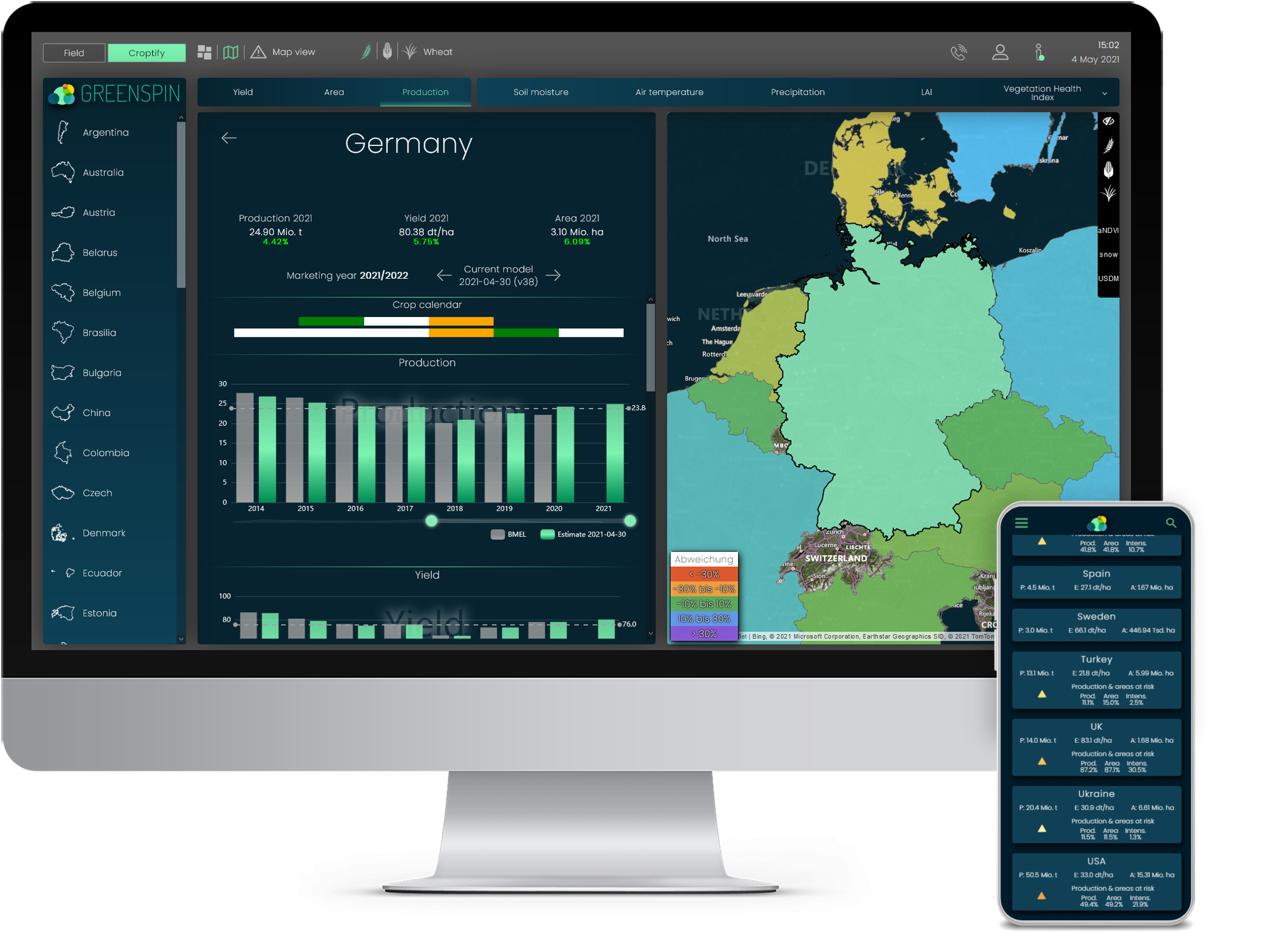
Weekly updated forecasts for yield, production, and cultivated area

Targeted monitoring of current risk areas for vegetation growth with history and severity

Overview of global yield predictions, USDA numbers, stock market data, news, and more

Effects of climate change on various crops for the IPCC climate scenarios

Information for wheat, corn, soybeans, and more. We are happy to include your crop as well!

Complex AI prediction models based on more than 890 million data points (15 years of historical training data for 16 parameters)

We daily update our data set from proven sources. More about our toolset

For over 10 years, customers have been praising Croptify's user-friendliness.
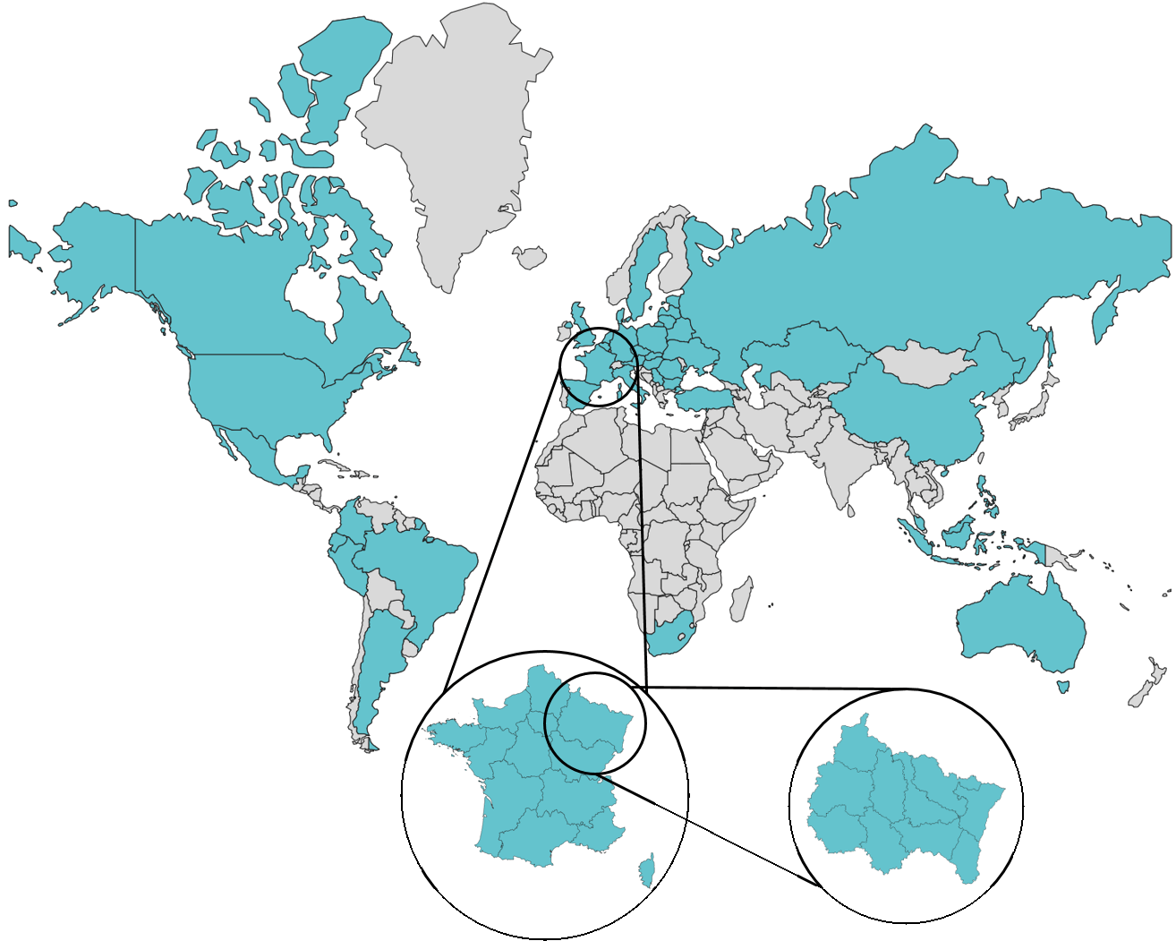
Croptify is available for over 30 countries. These countries account for more than 72 % of the production area for wheat and 53 % of the production area for corn. More than 90 % of the export volume of wheat and corn is covered. All growth-related information is available visually and in charts from the country level down to the district level.
Available in many languages: